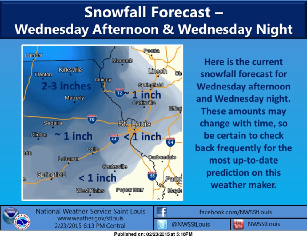
Winter Storm Warning in effect until 6:00 pm CST on Sunday
Tonight: Snow. Low around 25. East wind 5 to 7 mph becoming calm after midnight. Chance of precipitation is 100%. Total nighttime snow accumulation of 3 to 7 inches possible.
Sunday: Snow. High near 34. Calm wind becoming west 5 to 7 mph in the afternoon. Chance of precipitation is 80%. New snow accumulation of around an inch possible.
Sunday Night: Mostly cloudy, with a low around 20. Northwest wind around 7 mph.
Monday: Partly sunny, with a high near 35. North wind around 6 mph becoming east in the afternoon.
Monday Night: Freezing rain likely, mainly after midnight. Cloudy, with a low around 29. Southeast wind around 8 mph. Chance of precipitation is 60%.
Tuesday: Showers and possibly a thunderstorm. High near 51. Chance of precipitation is 80%.
Tuesday Night: A chance of rain before 8pm, then a chance of rain and snow between 8pm and 1am, then a chance of snow after 1am. Cloudy, with a low around 22. Chance of precipitation is 40%.
Wednesday: A 30 percent chance of snow. Mostly cloudy, with a high near 26.
Wednesday Night: Mostly cloudy, with a low around 8.
Thursday: Sunny, with a high near 24.
Thursday Night: Mostly clear, with a low around 13.
Friday: Sunny, with a high near 41.
Friday Night: Mostly clear, with a low around 26.
Saturday: Sunny, with a high near 46.
#AltonIL #ilwx # mowx #stlwx #PeacefulAlton #ClarkBridge #WinterWeather
#buzzmusicmedia


 RSS Feed
