PUBLIC SEVERE WEATHER OUTLOOK NWS STORM PREDICTION CENTER NORMAN OK
0146 AM CDT SUN APR 27 2014
* LOCATIONS...
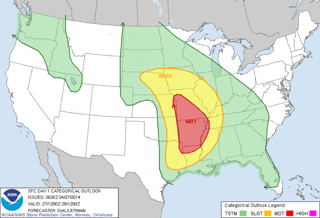
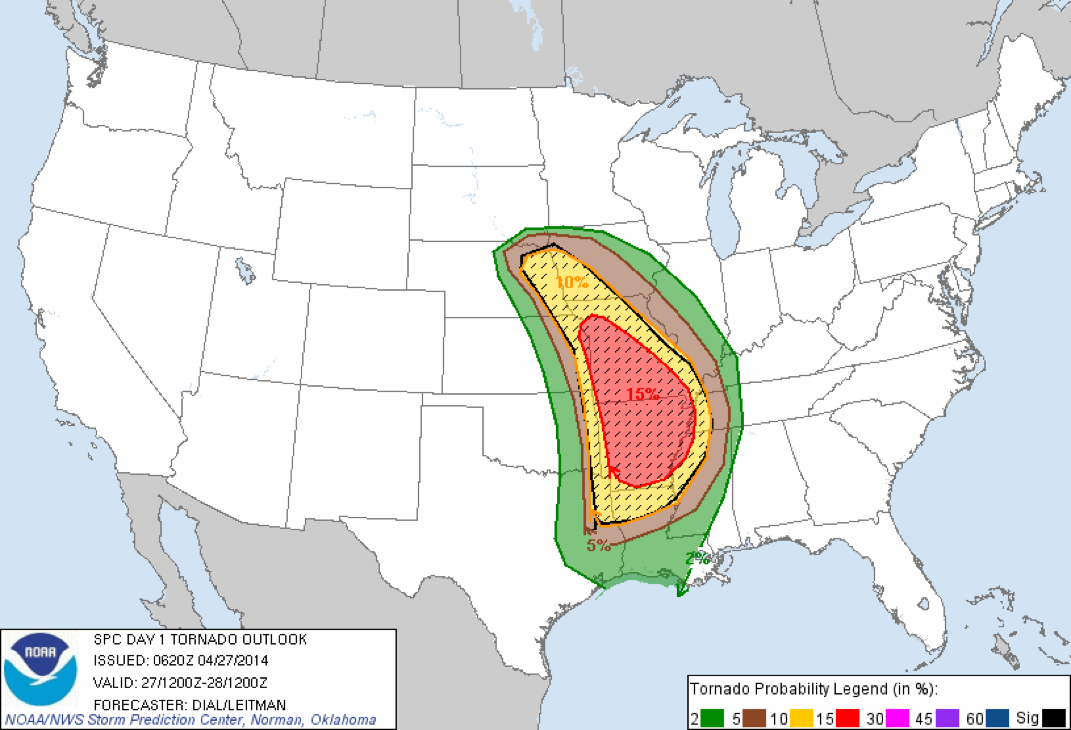
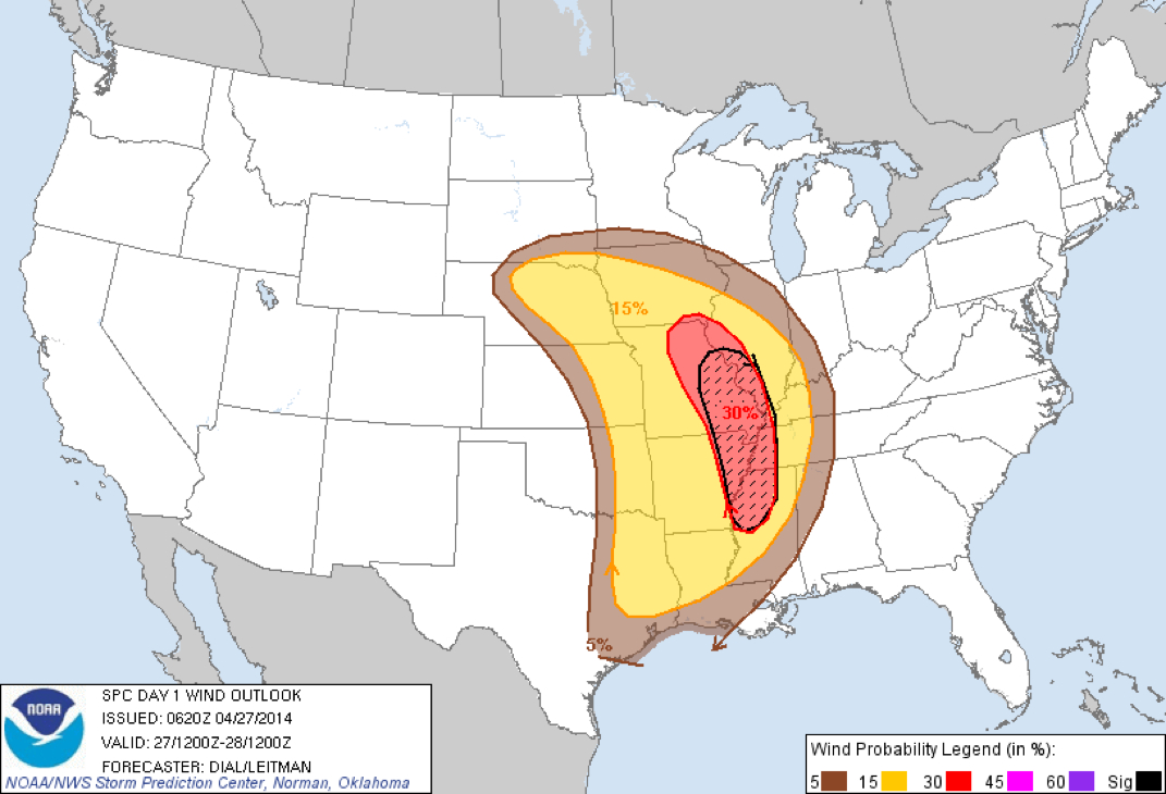
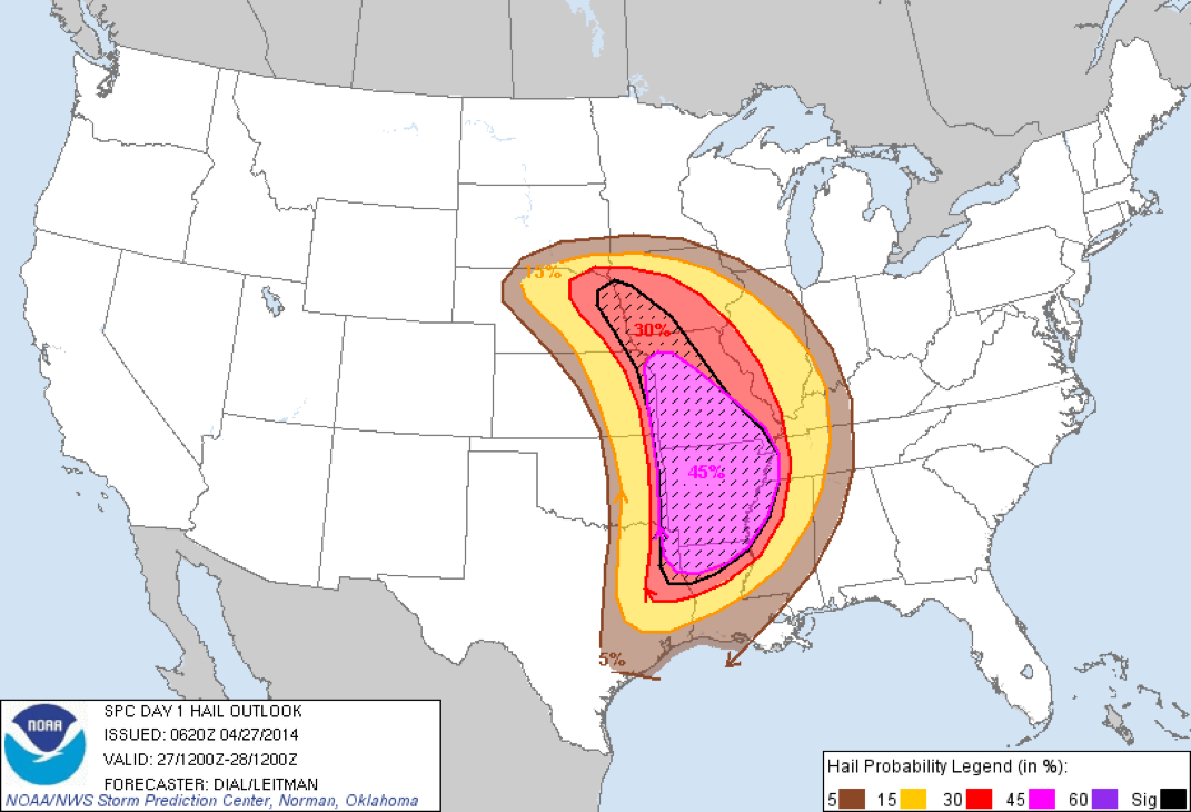
Arkansas Far eastern Kansas Northern Louisiana Western and central Missouri Northwest Mississippi Far eastern Oklahoma Western Tennessee Far northeast Texas
* HAZARDS... Several tornadoes, a few intense Widespread large hail, some baseball size Scattered damaging winds, some hurricane force
* SUMMARY... Numerous severe storms with potential for strong tornadoes...very large hail and damaging wind are likely across much of the Mississippi river valley, with the greatest threat from the Ark-La-Tex into Arkansas...western Tennessee and western and central Missouri and ern ks. A secondary threat area will be from eastern Nebraska into Iowa...and storms developing in this region during the day will also likely produce large hail and several tornadoes.
Preparedness actions... Review your severe weather safety procedures for the possibility of dangerous weather today.
Stay tuned to NOAA Weather Radio, weather.gov, or other media for watches and warnings.
A tornado watch means that conditions are favorable for tornadoes to form during the next several hours.
If a tornado warning is issued for your area, move to a place of safety, ideally in a basement or interior room on the lowest floor of a sturdy building.
..Mead.. 04/27/2014
 RSS Feed
