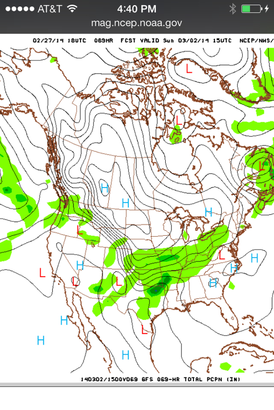
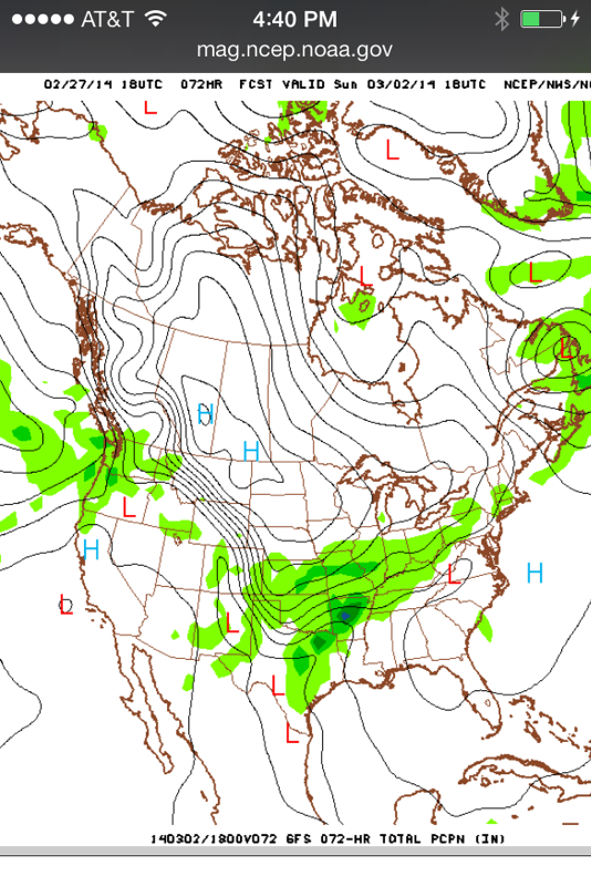
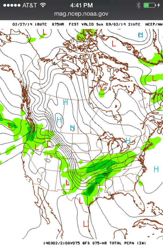
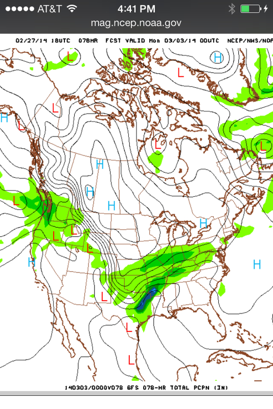
As of the Friday midday CST weather update of the GFS computer model, it looks like a prolonged winter weather event remains on track for much of the mid Mississippi River Valley region.
Storm track is still not iron clad - or in stone, if you prefer - but it seems a lock that northern Missouri, western and central Illinois will get a prolonged period of precipitation, with a good chance for snow to be the majority along the moderate precipitation area. Further south along and near Interstate 70, there is a chance the precipitation will be a mix of snow and sleet.
There will be several updated runs of the computer models between this writing and the start of the winter storm. But plan now for travel to be encumbered on Sunday into Monday morning.
The maps show the projected progression of the winter storm using the GFS model run from Thursday midday CST.
 RSS Feed
